


Tonight
Flurries.
- Snow: 9 cm
- Freezing level: 1000 metres.
- Alpine temperature: Low -3 °C.
- Ridge wind south: 25-35 km/h.
Saturday
Snow.
- Snow: 25 cm
- Freezing level: 1400 metres.
- Alpine temperature: High -1 °C.
- Ridge wind south: 25 km/h gusting to 55 km/h.
Sunday
Flurries.
- Snow: 6 cm
- Freezing level: 1600 metres.
- Alpine temperature: Low -3 °C, High 0 °C.
- Ridge wind southwest: 20-40 km/h.
Monday
Flurries.
- Snow: 12 cm
- Freezing level: 1400 metres.
- Alpine temperature: Low -5 °C, High -2 °C.
- Ridge wind south: 20 km/h gusting to 65 km/h.
Tuesday
Flurries.
- Snow: 6 cm
- Freezing level: 1200 metres.
- Alpine temperature: Low -5 °C, High -4 °C.
- Mostly light ridge wind occasionally gusting to 35 km/h.
Wednesday
Cloudy with scattered flurries.
- Snow: 5 cm
- Freezing level: 1300 metres.
- Alpine temperature: Low -6 °C, High -3 °C.
- Ridge wind south: 10-20 km/h.
Thursday
Mainly cloudy with isolated flurries.
- Snow: 1 cm
- Freezing level: 1300 metres.
- Alpine temperature: Low -3 °C, High 1 °C.
- Ridge wind southeast: 10-20 km/h.
Friday
Mainly cloudy.
- Freezing level: 1400 metres.
- Alpine temperature: Low -1 °C, High 1 °C.
- Ridge wind light to 20 km/h.
Saturday
Flurries.
- Snow: 6 cm
- Freezing level: 1300 metres.
- Alpine temperature: Low -3 °C, High -2 °C.
- Light ridge wind.
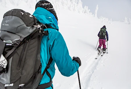


The storm drapes the mountain in fresh snow, its magic growing stronger by the hour. This afternoon will bring the best conditions, soft and deep for those who wait. Morning riders will find the groomers at their finest—smooth, fast, and true—before the powder works its quiet enchantment off-piste.
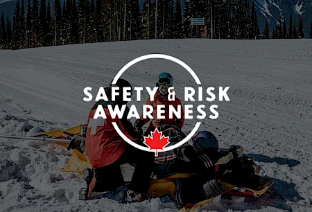
Backcountry Conditions
In the backcountry, conditions will be in flux as warm temperatures and ongoing snowfall shape the landscape. With each passing hour, the hazard level is set to rise, making careful decision-making essential. Stay aware, adapt to changing conditions, and check avalanche.ca for the latest avalanche bulletin before heading out.